Near 60 today, snow returns for Thursday
Today could be the warmest day since early December with the highs nearing 60 degrees. The sunshine will be evident early on, but clouds will move back in later today. This will kick up showers later tonight and early Wednesday around a cold front. This will just be the scattered variety!
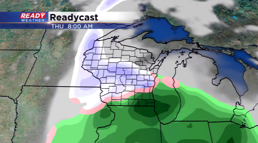
A bigger, more dynamic storm system rolls in from the Desert Southwest. This will drive in a complex forecast with a rain/snow mix developing on Thursday.
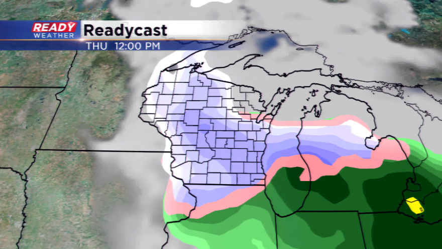
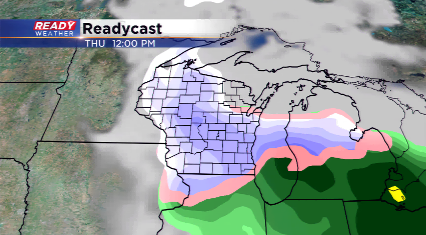
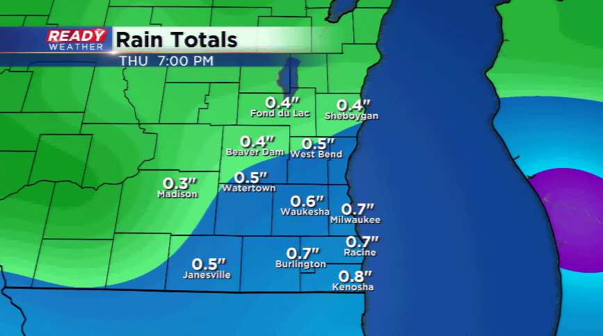
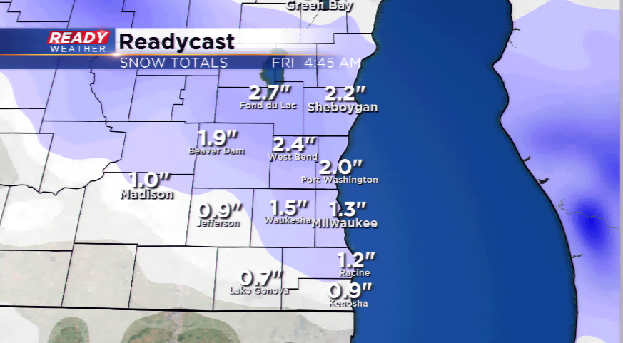
The precipitation will start to develop by Wednesday night. It will start out as rain, and continue with mainly rain Thursday morning, then turn to a sloppy snow for southeastern Wisconsin. The fine line between who sees more snow and more rain will be slicing through the heart of the viewing area. The forecast is showing a few more inches in the northern and western sections of the CBS58 viewing area, and possible a mark of 3”-5” in central Wisconsin. There’s a chance parts of the area could see 2”-4” of snowfall and other areas see 1”-2”.
There are a lot of details that will have to be figured out between now and Thursday. The bottom line is the expectation will be for snow during the afternoon and evening commute with snow-covered roads and slippery conditions. Expect changes to this forecast in terms of the snowfall expectations!
To stay up-to-date on this changing weather situation, please download the CBS58 Ready Weather App.