Mother Nature throws more snow our way Wednesday

-
1:51

Schlesinger’s Saturday Showcase (4/20)...Beer, frogs, anniversaries
-
2:26

Emotional vigil as family & friends tearfully remember Sade Robinson;...
-
2:50

Shouting, secret recordings, retaliation: What’s behind Thursday’s...
-
0:35

Third Ward Beer Garden kicks off season
-
1:01

City officials tour King Park neighborhood as a part of affordable...
-
3:00

2020 murder of Bernell Trammell’s remains unsolved
-
1:44

Kenosha community comes together to gift students with repaired...
-
1:50

Following fatal fire, MFD returns to south side neighborhood...
-
2:09

Marquette parents express frustration as graduation date remains...
-
0:51

City leaders gather ahead of Denim Day to address sexual assault...
-
0:53

City officials gathered in King Park neighborhood for tree canopy...
-
5:40

’48 Hours’ episode to feature Waukesha County eye drop murder...

Another storm system is expected to drop winter weather on top of the Badger State Tuesday night and Wednesday. Low pressure from the Rockies barrels towards the area tonight resulting in widespread snowfall. There’s even an opportunity to see freezing rain, ice, and a mix in some spots. The timing of the system will cause travel headaches in the morning Wednesday.
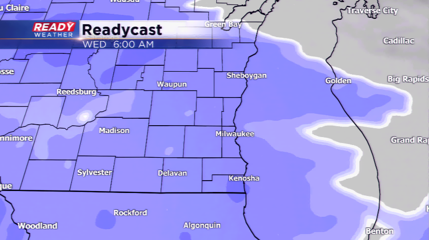
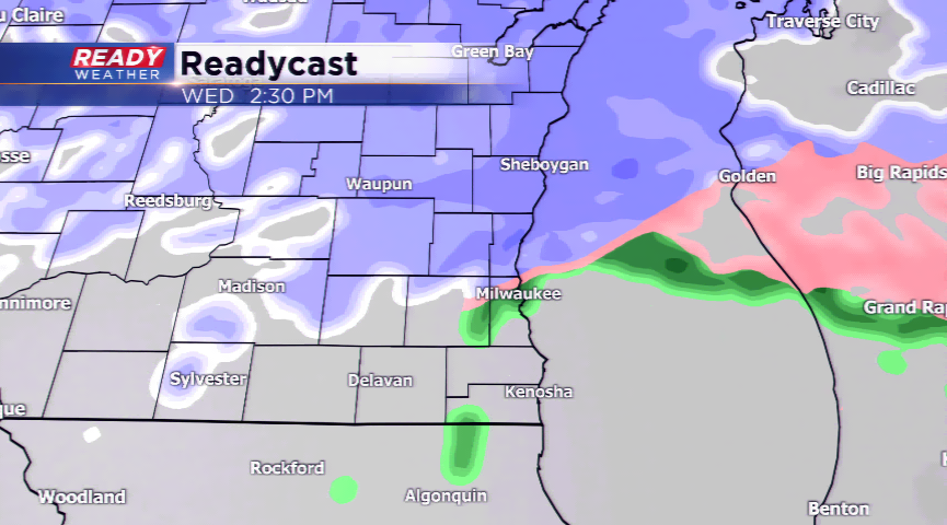
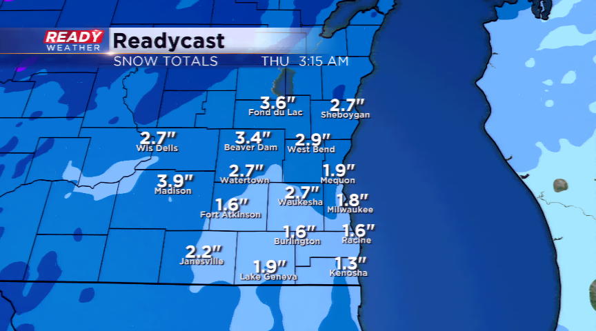
The activity drives in after midnight tonight, and really picks up by daybreak. Most sections in the metro will see 1”-3” of snowfall along with a mix; those totals may be higher more north with cooler air. A Winter Weather Advisory may be needed for this next round of precipitation.
Temperatures will not take a nose dive. In fact, we will be mild the rest of the week and this weekend. We’ll have to keep an eye on Friday and this weekend with another incoming storm. This storm has many uncertainties, but it has the potential to be a doozy for parts of Wisconsin. Stay tuned!