Heat advisory posted, hottest temps of the season
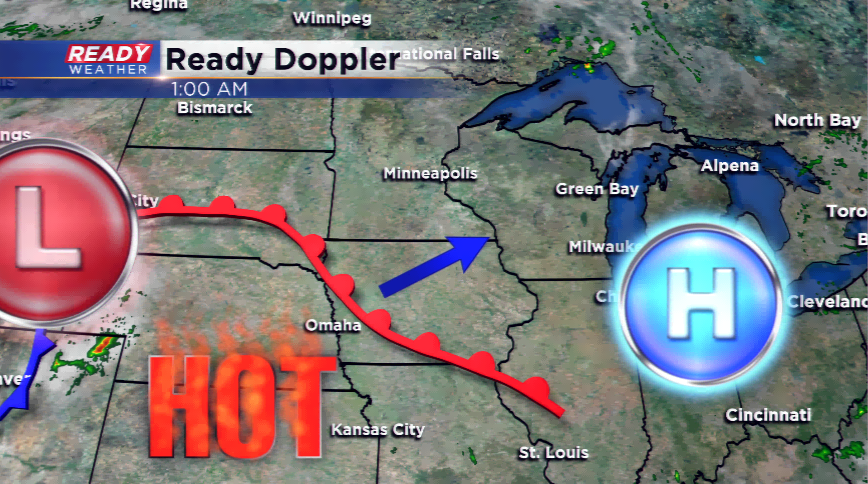
Besides the mini heat wave we had two weekends ago, it has been a below average month of June and cool start to summer. Expect summer to get kicked into high gear starting today with a broad upper-level ridge developing for most of the country. This will send in the hottest air of the season to southeastern Wisconsin.
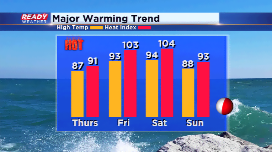
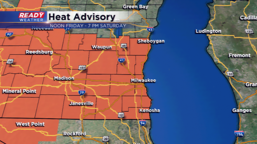
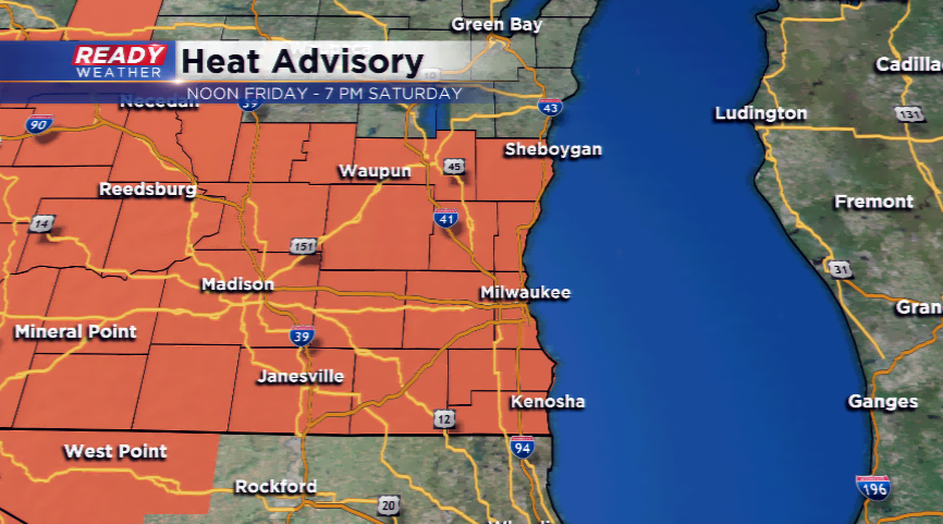
Due to the heat and humidity, a Heat Advisory has been posted by the National Weather Service in Milwaukee. It is for the whole viewing area, and it starts at noon Friday, and runs through 7 pm on Saturday. Temperatures are expected to rise well into the 90s, with heat index values ranging between 100° and 109°. With dew points into the 70s, this will lead to very dangerous conditions outside; make sure you are getting plenty of breaks if you have to spend time in the sun, and get plenty of water.
The computer models are hinting at slightly cooler temperatures hugging the lakeshore, so there might be some relief there. Watch for a few pop-up storms developing from daytime heating; improving chances of storms could arrive by Saturday night and early Sunday. Some of these storms could be strong.
The heat will break a touch by next week, but the 80s will linger into the holiday. I told you summer is here, and it looks to be here to stay!