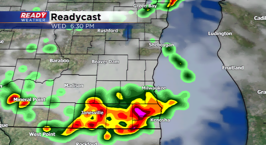
Flash Flooding Remains Possible Today With Severe Storms
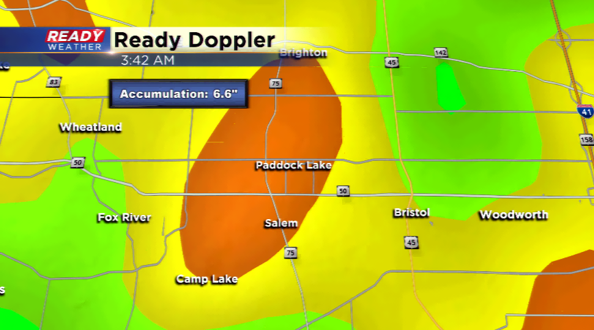
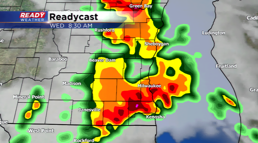
Flash flooding once again is a problem around southeastern Wisconsin this morning. Reports out of Paddock Lake, Elkhorn, and Salem showing over 4" of rainfall. Radar indicated rainfall totals near the Paddock Lake area calculated 6.6" of rain!!! Ample moisture feeding along a warm front and low pressure system is setting the stage for thunderstorms throughout the day. Some of these storms could be strong to severe. Another round is possible this morning with a secondary round this afternoon and evening depending on how much sunshine and instability is built.
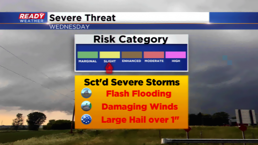
The Storm Prediction Center has all of southeastern Wisconsin under a slight risk of strong to severe storms. The primary threats continue to be flash flooding. Some storms could have embedded damaging winds and large hail. Highs today soar into the 80s and near 90, especially with sunshine. The muggy air is what you will. Dew points
A sweeping cold front will jump start more thunderstorms this evening and overnight. Once those move out, expect gradual clearing skies on Thursday. Less humidity and cooler temperatures are forecasted for the rest of the work week.