Dry for now, cooler and wet weather on the way!
High pressure kept the temperatures comfortable and the sunshine out around southeastern Wisconsin all weekend. Looking back at the summer of 2017, this will likely be labeled as the best weekend of the whole summer.
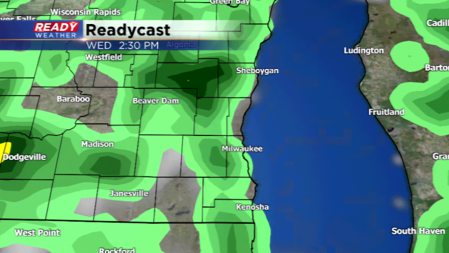
Early this week will almost be a repeat of the weekend with lots of sunshine. We will begin to see an influx of humidity and high pressure moving away. This will bring in a spotty chance of a shower or storm tomorrow and tomorrow night. The chances start to increase by the middle of week with a cold front and disturbance aloft. Right now the chances of showers and storms will be there, but it doesn’t look like a big risk of severe weather.
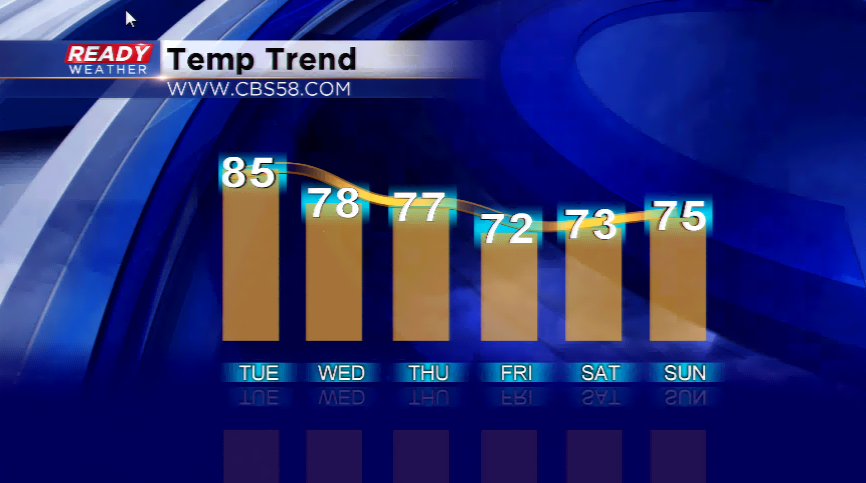
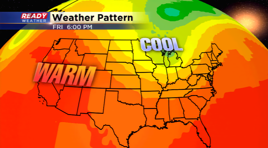
Behind the cold front, highs will plunge back into the 70s through the weekend. Friday and Saturday will be the coolest stretch over this weather pattern. Only one day this summer has been below 70 degrees for a high temperature in Milwaukee. Depending on the timing of rain or sun, there’s a chance we have a day or two below 70!