Couple of Bumps in The Weekend Forecast
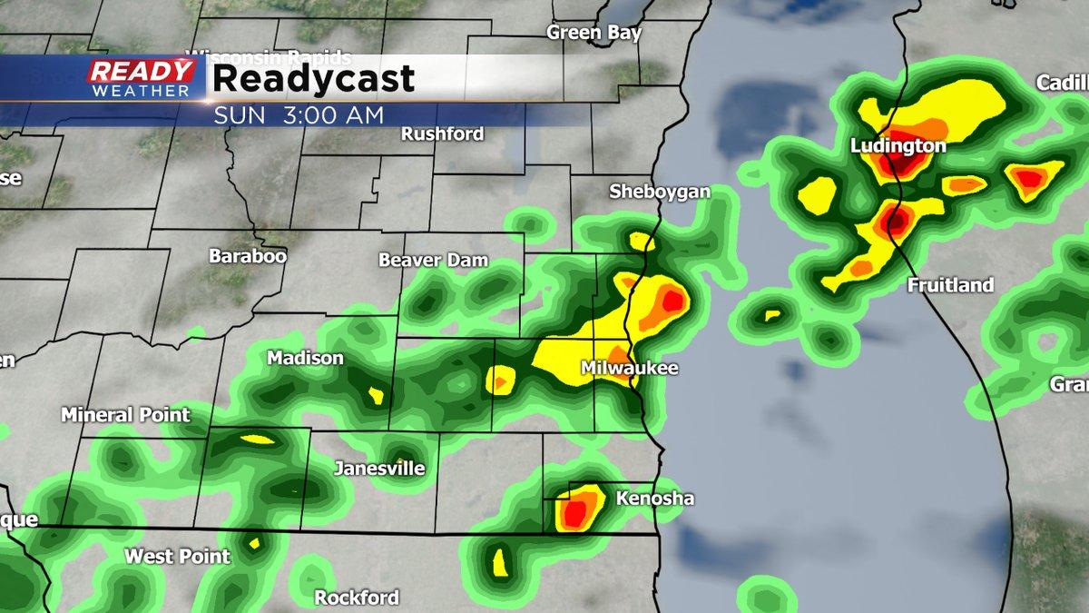
After a chilly start this Friday, look for abundant sunshine to warm us up into the 60s, seasonably mild in spots. Then, lows tonight will be milder with readings only in the 50s. Our next weather maker will cause showers and thunderstorms to fire late Saturday night into Sunday morning at least. There could be more as well later on Sunday. We even have a marginal risk of severe weather, especially northwest and southwest of Milwaukee.
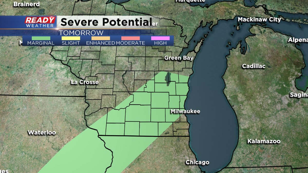
In other words, one or two storms could be on the stronger side with gusty wind, heavy rain, and even some hail.
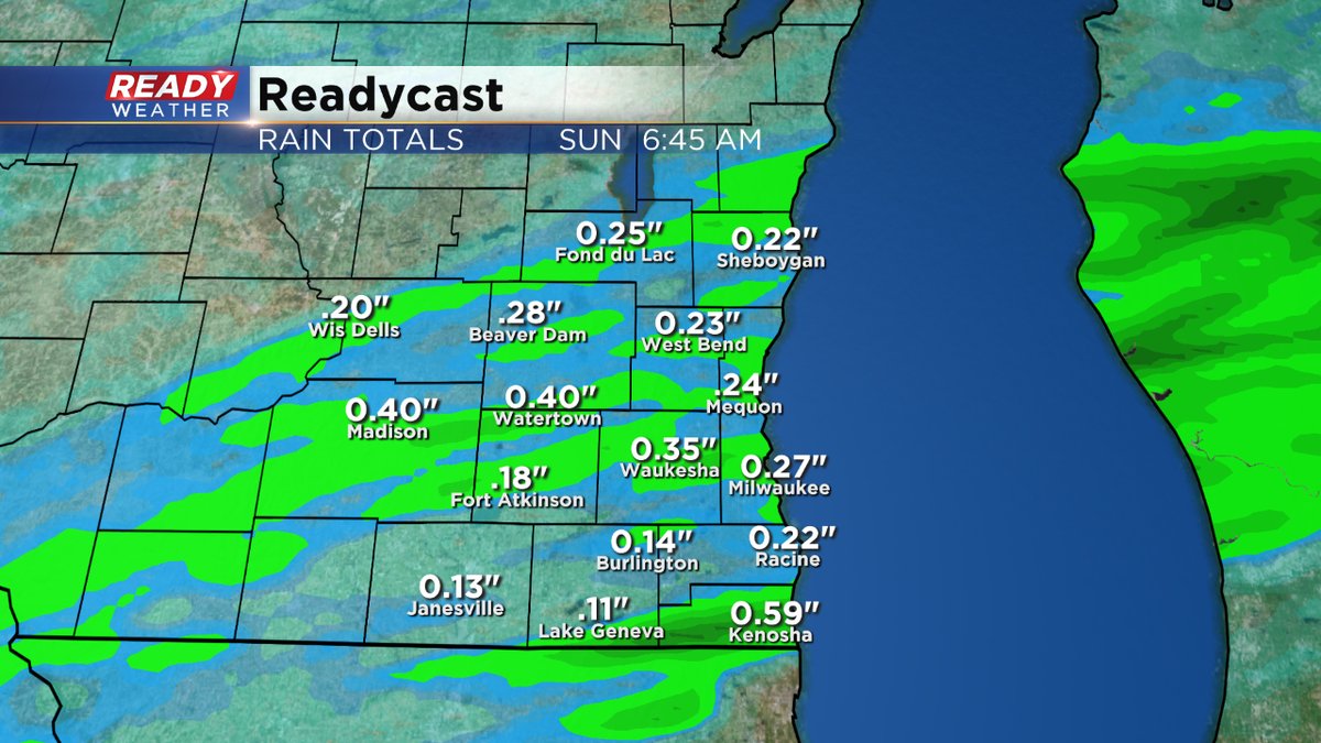
Rainfall amounts could easily top a quarter to a half of an inch through the weekend.
We start out next week on the mild side of things with highs in the low 70s. Then a sharp cold front moves through some point on Tuesday, helping to drop the numbers back to more seasonable levels.
To keep track of all the weather changes, make sure to download the free CBS58 weather app, especially when the storms start to fire late Saturday night and early Sunday.