4 PM Update: A severe thunderstorm watch will be cancelled
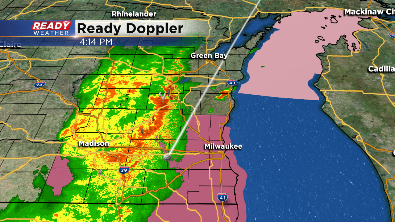
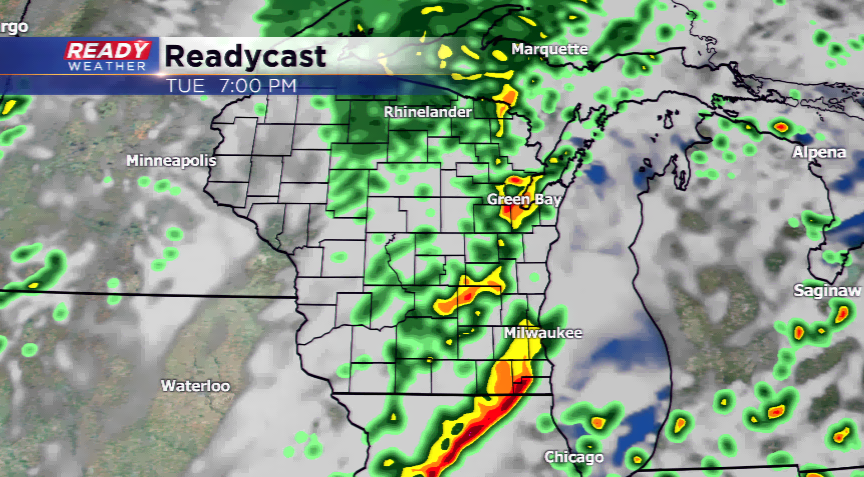
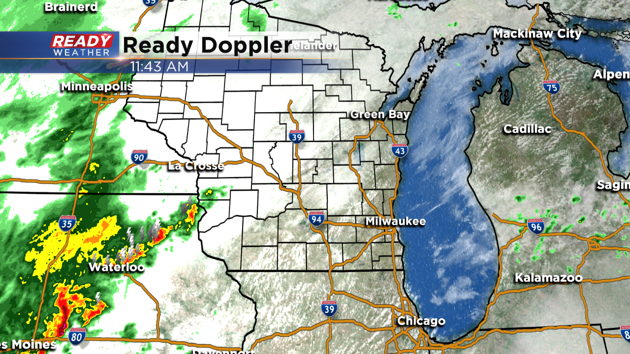
Thankfully the greatest instability has remained south across northern Illinois this afternoon. That area is experiencing strong to severe storms. Closer to home we are watching a line of rain and a few embedded storms; however, it's not showing severe characteristics.
The NWS will cancel the watch as the rain moves through. Expect rain through the next couple of hours. Severe weather is not expected.
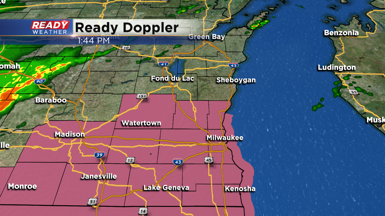
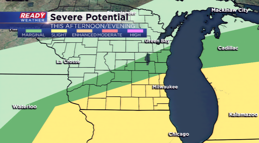
Heat and humidity will combine to produce strong to severe thunderstorms this afternoon and evening. A new severe thunderstorm watch has been issued for the majority of the area until 10 pm.
Damaging winds and hail are the primary threats. The main line of storms will arrive between 4 pm and 8 pm.
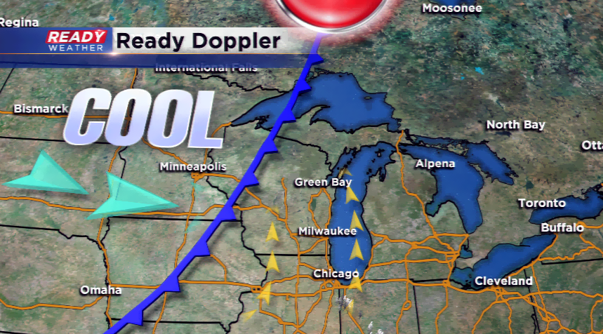
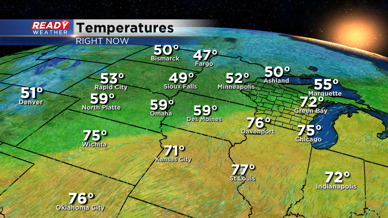
A surface cold front will swing into the area today and bring in cooler air the rest of the week. However, ahead of the front we are anticipating warm and muggy air. Highs could track into the upper 70s to around 80 today with dew points in the mid-60s. With those conditions and a front, this could lead to a chance for severe weather.
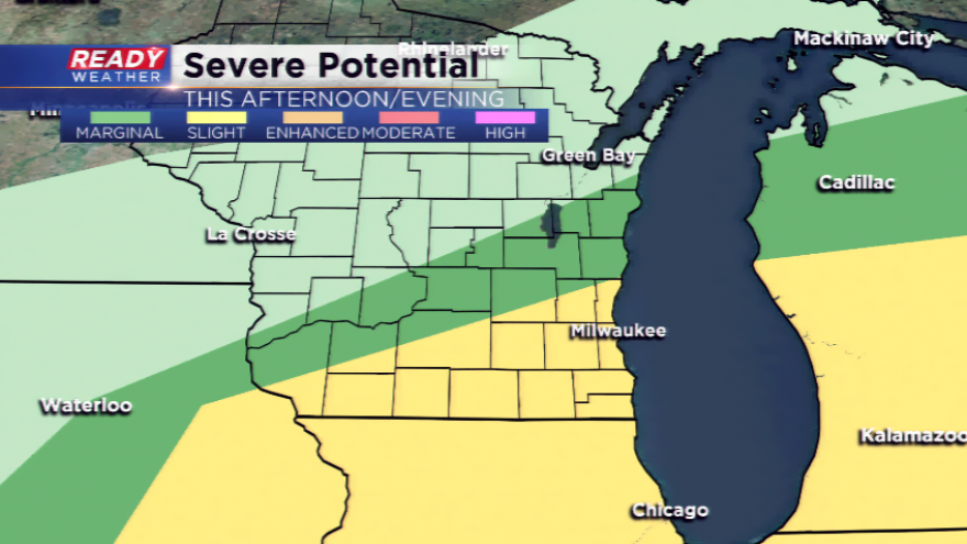
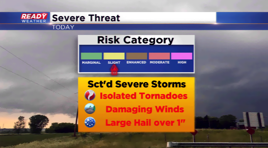
The Storm Prediction Center is forecasting a slight risk of severe weather for a chunk of southeastern Wisconsin. This setup could bring a line of thunderstorms into the area by this afternoon and evening. The biggest threats will be large hail and damaging winds with any storms that fire. There could be heavy downpours embedded in this line, which could lead to minor flooding and ponding of the roads. The storms will be out by 10 pm this evening.
Behind the front expect fall-like air with highs in the 60s the rest of the week. Another cold front late this week could drive in even cooler air with daytime temps in the 50s by early this weekend.