Calmer Day Today with Heat on the Way!
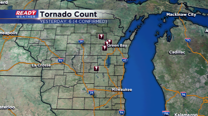
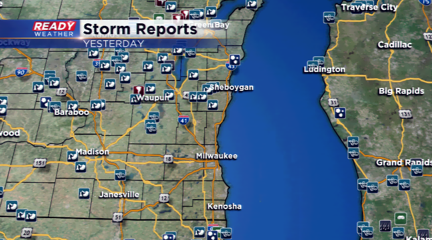
The Badger State had its fair share of severe weather yesterday including four confirmed tornadoes and dozens of wind and hail reports. The four tornadoes were in Menominee County, Outagamie County, Shawano County, and Green Lake County. Our viewing area saw 13 storms reports, mainly wind damage in our northern counties.
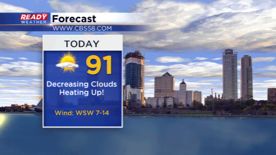
Those storms have moved out, and a few lingering scattered thunderstorms are possible this morning. Otherwise, expect a drier day with lots of sun. Residual warm air will stick around today even though a weak cold front moved through the region. Highs will make it back to 90 degrees for a chunk of SE Wisconsin.
The atmosphere turns more active to end the work week and heading into the weekend. Lift, moisture, and some instability could lead to thunderstorm activity by Saturday, and especially during the night hours along a strong disturbance. Keep a heads up to the forecast for strong to severe thunderstorms to fire along that wave. The Storm Prediction Center has a slight risk of severe weather already for southern portions of Wisconsin including parts of the CBS58 viewing area.