Busy times ahead this week in the CBS 58 Ready Weather department

-
5:03

Transparent Watercolor Society of America’s 48th annual exhibition...
-
4:08

Kiwanis Club gears up for 10th annual iPads for Autism event...
-
2:22

Scattered showers and storms expected Tuesday afternoon and evening
-
2:12

Meet CBS 58’s Pet of the Week: Joey
-
2:59

Natalie’s Everyday Heroes: Indy Slot Car Series going strong...
-
2:23

Sen. Ron Johnson calls for ’education campaign’ that includes...
-
1:46

History Channel star judges international contest at MSOE
-
2:09

Gov. Evers tours newly renovated Germantown Recycling Facility
-
2:04

Wisconsin nursing home advocates push back against new federal...
-
1:43

’It’s usually the innocent ones that are taken:’ Family...
-
2:20

Sade Robinson murder: Maxwell Anderson pleads not guilty to all...
-
1:22

’We all have a responsibility’: Volunteers pick up litter...

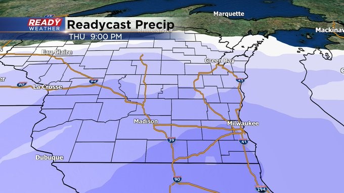
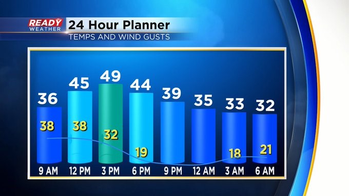
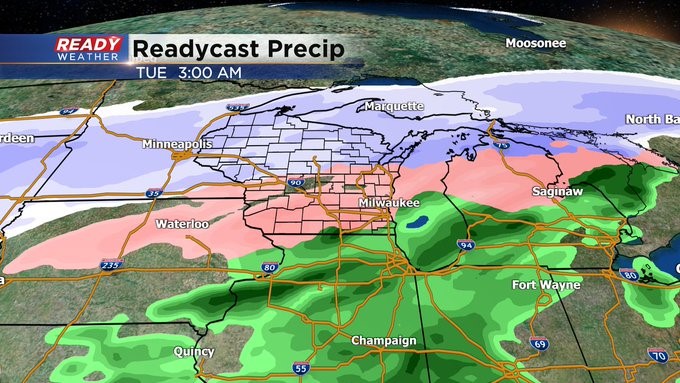
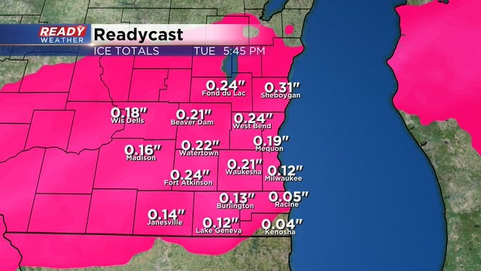
MILWAUKEE (CBS 58)--From the wind machine in place on Sunday to the ice storm potentially setting up Monday night and Tuesday to snow on top of that Thursday night and early Friday. We certainly have enough to talk about for a while.
Keep in mind our Wind Advisory today goes from the mid-morning hours until the middle of the afternoon on Sunday. We could see gusts more than 45 mph. Winds will calm down tonight as we get behind a cold front. A few Lake Effect snow showers are possible into Monday morning. Then our larger system sets up Monday night and much of Tuesday with low pressure to the south. As it stands now, we could be talking about an ice event with freezing rain and sleet, perhaps accumulating on trees and power lines. All the major snow accumulations will be well north of us. The Northwoods could see more than a foot!
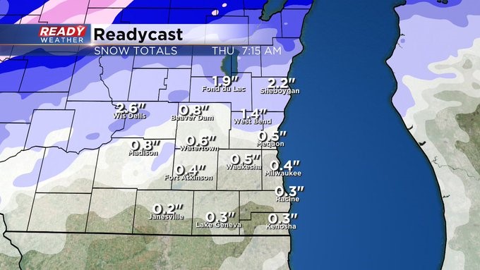
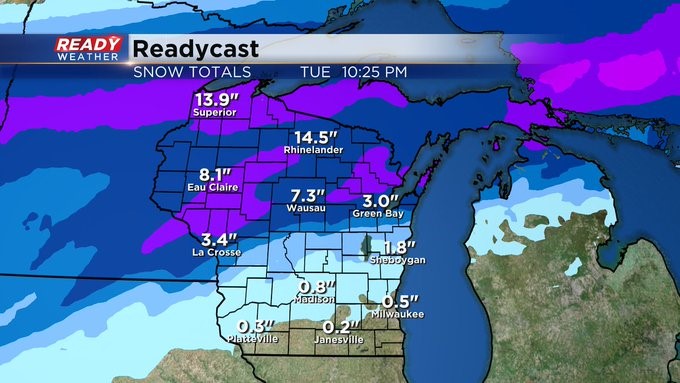
Then a snowy system will impact us Thursday night into Friday morning with accumulating snow possible then. Stay tuned like they say in the TV business.